REMUS 6000
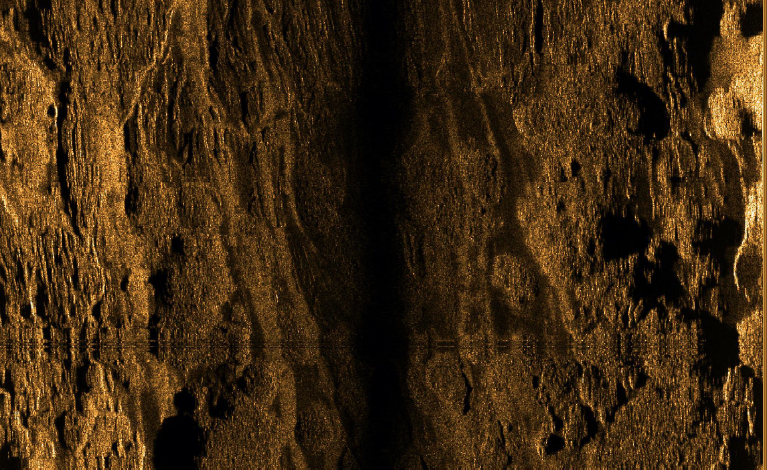
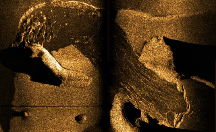
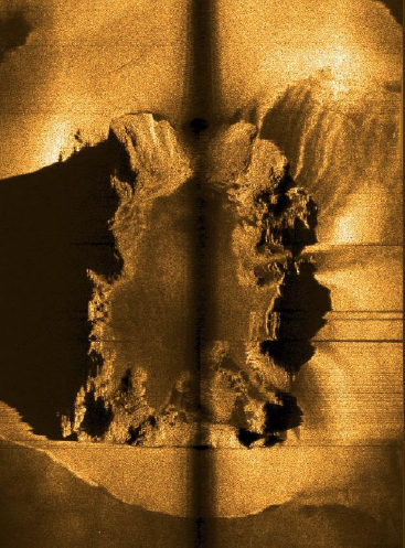
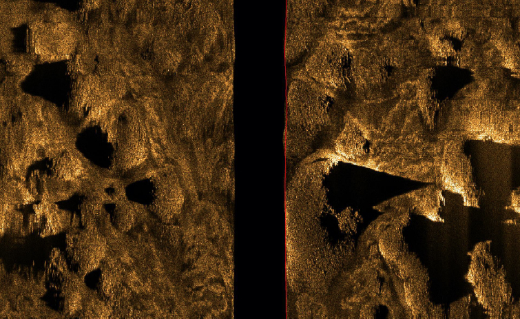
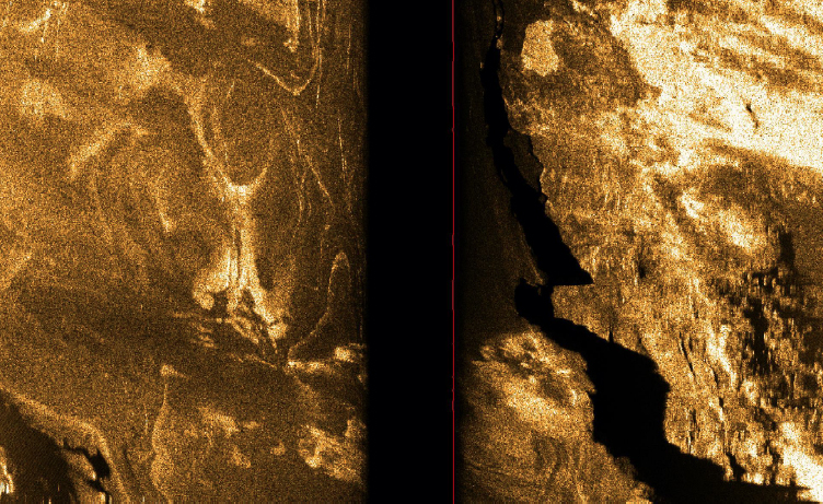
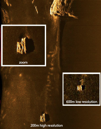
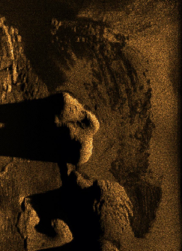
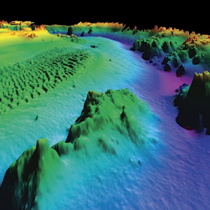
The digital images displayed in this viewer were created using side scan sonar (returned pulses of reflected sound).

 Today the Eustace Earhart Discovery Expedition 2017 comes to a close. Yesterday I took the opportunity to thank Alan and the rest of the team that made it happen, and I am sincerely grateful for the privilege of sailing with everyone. Captain Noe and the crew of the good ship Mermaid Vigilance came to our last operations meeting and thanked each of us one by one with handshakes, high fives, and hugs. After just a few weeks together we feel like old friends, and I was truly touched.
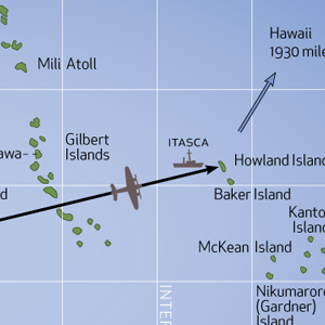
As you may have gathered, I cannot announce that we found the Electra. However, it’s worth focusing on what we did accomplish. We covered 725 square nautical miles this expedition, a record for Nauticos. Our tally in three expeditions is nearly 2,000 square nautical miles, and with the coverage by the Waitt Foundation in 2009 we’ve mapped an area the size of Connecticut at 1 meter resolution or better. This is one of the largest contiguous areas of the deep ocean mapped in history. We have discovered seamounts, calderas, and volcanic cones never seen before. We mapped a large portion of the Howland and Baker Islands Marine National Monument, and helped guide NOAA’s recent expedition to the region on Okeanos Explorer. The new data will be provided to geologists and other scientists in the near future.
Expedition performance was exemplary, including our Nauticos team, WHOI, the ship, and all support elements. We completed the 1,800 square mile high probability search area we set out to cover in 2002. Alan said, “You and the team have done everything you said you would, and the equipment and people performed near flawlessly. No reason to hang your head low.We either missed it somewhere or just didn’t cover the right spot.”
Of course, analysis always leaves residual possibilities, even without altering assumptions, and the source data hasn’t changed. We also have very valuable new search coverage to consider. The technology we used to search the seafloor has improved with each expedition, and we look forward to future work with WHOI using next-generation AUVs.
We will take another look at all of our work, and have already made a to-do list. We will return home, take a well deserved rest, then get back to it!
— Dave Jourdan
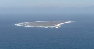
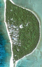
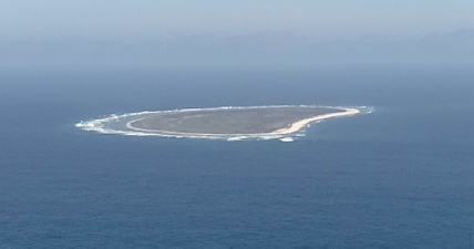 Recently while transiting between areas the expedition team got a glimpse of the island that Amelia and Fred never saw. Lit by a brilliant afternoon sun, a thin strip of beach bordering a scrubby patch of land appeared on the horizon. The island is featureless except for the Amelia Earhart Beacon, a “Keep Out” sign, and some mysterious mounds that even Elgen could not identify. Something to do with Easter Island? Equatorial beaver dwellings? Yet another mystery to ponder as we floated near the tiny island. We could approach no closer than 3 miles due to Fish & Wildlife rules. For a closer look, Bill launched his camera-equipped drone and flew to within 2 miles at 1,000 feet, capturing the image on this page.
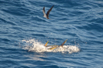
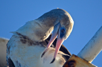 As we approached the island and cruised over the rising seamount that is its foundation, an abundance of sea life emerged. Besides our regular booby companion perched on the yardarm, we saw ahead a frenzy of birds feeding on a swarm of small fish. A lucky camera shot caught one of the tuna that were pursuing the little fish from below, herding them against the surface. As the small prey tried to escape the feeding predators, they became lunch for the hungry seabirds. Clouds of birds were seen in the distance blanketing the island, a remote stopover in their migratory meanderings.
 Sallie took the opportunity to fly her kite provided by the NASA Aerokat program and collect some atmospheric data. A gaggle of onlookers gathered on the roof of the bridge deck for the best views. We imagined the thoughts of the handful of colonists arriving to this tiny scrap of land, barely the size of the Washington D.C. Mall, mere inches above sea level, where they were expected to take up residence and eke out an existence.
Soon the little drone buzzed back, eyeballed the spectators, and settled onto the back deck. Sallie recovered her kite. Time to move on and get back to work, mapping the seafloor miles below. We left Howland with thoughts of Amelia and Fred, and the island they never found.
 Today we end operations in the Central Pacific after 42 days at sea (no April fooling!). We still have several day’s transit to Majuro where we will disembark, and most will have to wait a couple of days before we can catch a flight to Honolulu, and then home. So we have another week to go before seeing our families, a bit over seven weeks for most of us. Of course, Mermaid will be back at sea after just a day of demobilization (removing the WHOI equipment for shipping to Massachusetts) and will spend another couple of weeks transiting back to Singapore. It has been a long but rewarding voyage as we have added over 700 square-nm of new knowledge of the seafloor, learned new skills, made new friends, and enjoyed spending time with former shipmates. As we turn our bow west and head for port, I would like to acknowledge the efforts of “cast and crew” and express my gratitude for your good humor, professionalism, and companionship.
For Captan Noe Flores and the crew of the Mermaid Vigilance, Bravo Zulu! In a letter I will be sending to their company, MMA, “Mermaid Vigilance, MMA and the officers and crew have all exceeded my expectations. The vessel performed flawlessly each and every day of the charter. Every customer need was fulfilled completely.” I cannot say enough about their dependable, trustworthy. and friendly service. Many, many thanks! (Also a special thanks to Ship Superintendent Alfher Hernandez of MMA for helping to get us underway and for the supply of Snyder’s Pretzels!)
Of course, none of this would have been possible without the support of Alan Eustace, explorer, adventurer, and scientist. Besides his financial backing, he was also a key participant. His time on board was well spent as he eagerly soaked up new knowledge about our technology and operations, and was a source of wisdom and decision making at every juncture. I valued his quick grasp of every situation and action-oriented conclusions. I hope to have the privilege of working together again in the future.
Here at sea, I had the opportunity to work with deep-sea autonomous vehicle technology provided by the Dalio Foundation and the team from WHOI. Greg Packard led the group, helped us understand how to efficiently use the system to maximum benefit, worked calmly though crises, and contributed to our decision making as the mission proceeded. Christopher Griner, Neil McPhee, and Mark Dennett worked tirelessly to deploy and recover REMUS, drop, survey, and recover transponders, and were great shipmates though it all.
Spence King led our operations with efficiency, grace, and good humor. All of his expertise as a mariner, U.S. Navy commanding officer, and manager was put to the test. His work began on this expedition back in December, but that doesn’t count many unpaid hours helping me get the project back to sea over the years. I have learned a lot from him about teamwork, management, and celestial navigation, though I fear I will never be his best student in the School of Hard Knots.
It was great to sail again with Tom Dettweiler and we were lucky to have his skill and experience on board. He and the WHOI team worked together seamlessly and Tom was a valued analyst of the sonar data, backing up Jeff Morris. Jeff led the processing and evaluation of the sonar imagery from REMUS, and gave us confidence that we were sorting out targets from geology and rocks from seafloor jetsam. He also proved to be our best drone pilot. Cap’n Joe Litchfield rounded out our operations team and provided a healthy dose of true seamanship as well as some “true” sea stories. He was a valuable assistant to Spence and a great shipmate. His stint as a basketball ref was wanting, however.
The Media Team led by Bill Mills and supported by Bryan “MacGyver” McCoy was everywhere. From hand-helds to pole cams to Go- Pros to drones, they covered the expedition from every angle. We enjoyed Bill’s company in 2002 and were glad to have him back. This time, we were able to share our videos with folks at home, which I know were appreciated. Bryan handled his first venture to sea with aplomb, and helped keep the network and just about everything else up & running at sea, sometimes with imaginative solutions drawn from his “Felix the Cat” bag of tricks.
This trip we had a fully functional Education Team led by Sallie Smith. In past expeditions our activities were kept under wraps by sponsors, but this time Alan supported a STEM outreach program and we took advantage of it. With help from Rockwell Collins and the SeaWord Foundation, Sallie and her cohorts, journalist Marika Lorraine and jack-of-many-trades Sue Morris shared learning modules and videos about sea life, remote sensing , weather, and oceanography with students and the interested public back home. Marika doubled as reporter for Passages, and was especially helpful with Spotlight interviews as well as professional intros for Bill’s videos. Sue, a three-time veteran of Amelia expeditions, also organized imagery and supported the REMUS team as an operations assistant.
 Also sailing for the third time were Rod Blocksome and Tom Vinson, The Radio Guys. With an array of communications gear, they did their Ham thing as well as support of the education outreach program with Skype calls to students and ISS communications. They also provided vital input to the navigation analysis effort, with the help of folks back in Iowa from the Collins Amateur Radio Club.
Another three-timer was Jon Thompson, who cheer-led every step of the way, and helped us collect Amelia-belia for posterity. Back for more abuse was Doc Pam Geddis, who was called upon a few times for (thankfully) minor scrapes, and was a great sailor and tolerable Amelia impersonator.
Of course, Captain Elgen Long joined us for the third time, and provided sage advice, tales of aviation adventure, and a ready fount of knowledge about Amelia, Fred, and the Electra.
We could not have managed without Charlotte Vick who handled ashore liaison and organized our re-supply mission and Alan’s trip to the site. It’s not easy finding vessels that can sail 1,600 miles with cargo at a moment’s notice, but she did it. Thanks to the captains and crews of SauVage and Machias for their help with that. Besides the critical stuff, Charlotte also made sure we had the little things from tissues to towels to chocolate that made life at sea a little easier. And she handled PR!
Also back home were Jenne James and Bethany Lacroix managing the website, communications, and details getting us underway. David Kling, Master of Coin, has kept the cash flowing smoothly. Louise Mnich took on the challenging task of negotiating and reviewing contracts, gave legal advice, and says she enjoyed it! We sure appreciated it! Also ashore answering questions and running Monte Carlos upon request was Professor Jeff Palshook, who we look to for Mat-Lab wizardry and expert historical research.
This expedition was launched on the foundation of two previous trips in 2002 and 2006, funded by Earhart Discovery and its sponsors and investors. Besides those on board who have supported the venture, Gary Bane, Julie Nelson, and Bruce Crawford have been providing help and guidance from shore. To get her we have finally completed the search we set out to accomplish in 1999, and improved our map of the deep seafloor by an area the size of the State of Connecticut. Thanks for your persistence and unflagging encouragement.
Last, but hardly least, our friends and families back ashore deserve our heartfelt appreciation for handling all of the domestic details we had to neglect and for continuing support and inspiration. We certainly all look forward to returning to home & hearth.
However, I predict we will all hope we can go to sea together again someday, and I surely will look forward to that opportunity. Thanks, shipmates all!
Dave Jourdan, President, Nauticos
Yesterday Cap’n Spence told us about trading “snipes” while commanding the salvage ship USS Brunswick not far from the waters we are currently sailing. The story concludes:

Reiche was a direct descendant of one the Micronesian wayfinders, the long range voyagers in canoes who navigated by stars without instruments across the Pacific carrying their culture and their legacy to new islands. National Geographic later featured a story on how this knowledge was passed orally down through generations from teachers to students over a lifetime. The culture required those students to be the teachers for the next generation. That knowledge and those skills were becoming lost in the modern world.
So I asked him how he came to join the U.S. Navy? He said that he was very lucky to have this opportunity for a better life. The Compact of Free Association allows FSM citizens to join the U.S. military without having to obtain U.S. permanent residency or citizenship. He had good grades in school. He was invited to join, and was inducted directly into the U.S. Navy. I told him about the deal I made with his captain on the Beaufort. I wanted him to help me make a positive impression for the Navy. In addition to all his other duties, I asked him if he would agree to come up to the bridge before we stop at each of the islands. Explain who the chief was, island history, their problems, and how could we help. He agreed to all of that. So I asked if he would call the islands for me in Marshallese on the radio, tell them who we were, find out the best place to anchor, where we could dive, and find out what things to bring with us. He agreed to all that too. Now we were all warmed up and this conversation was going quite well. So I asked him what island was he from. It was a name I had never heard before, Mog Mog. I asked him to show me on the chart. He read it expertly. “Right there, Ulithi Atoll.” Ulithi was one of our stops. It was a volcanic atoll about 40 miles long and 10 miles wide comprised of 40 islands. Only four of them were populated. We were planning to visi t Falalop, but Reiche’s home island was only 5 miles away. His wife now lived there with his extended family. They were married just three weeks before he left for the United States. That was two years ago. All of a sudden I realized what that difference was that I could make. “Reiche, how would you like to go home?”
In the early morning of entering Ulithi Atoll, I had Reiche on the bridge with me. I handed him the microphone, and explained how vessels identify themselves and use the channelized frequencies. He said that he got it. He took the microphone. Using the international hailing frequency VHF-Channel 16, he started transmitting a long message in rapid staccato. Not a word of it was recognizable until he finally ended it with “Brunswick.” Silence followed. He said a few more dozen words…”Brunswick.” Then the radio came to life with excited chatter from the other end. Reception was excellent. Back and forth. Reiche was smiling and laughing, and more rapid fire back and forth. I had nothing to do at this point, so I just imagined what he was saying. “Yo, Hoolio, hey it’s Reiche, ya know, from Mog Mog. Yeah, I finished school, got married, joined the U.S. Navy, seen some world, it’s cool. Dude, you’ll never guess what, they gave me my own ship! Yeah, a big one, out here in the lagoon. I’ll stop by later.”
Reiche handed the microphone back to me. He said we’re all set. They were expecting us.
We anchored at Mog Mog. I got as close as I dared. The sandy bottom was studded with threatening coral heads and rocks. Normally, I send a small team in the first boat to meet the chief and assess the circumstances for the visit. This time I made sure Reiche and I were in the boat. We landed on the white sand beach in minutes. No one was there to greet us. I said to Reiche, “go on, go say hello to your wife and family, tell them all about navy life, and tell them you brought some friends home with you, we’ll wait here.” He was only gone about 15 minutes. He invited us all up to his home to meet his family. I accepted the invitation and met with his parents, his wife, his younger siblings, the aunts, the uncles, the chief, the elders. I told them all how proud we are to have a man like Reiche in the United States Navy. He has worked hard, he has an important job, and he does it well. In fact we would welcome more young Micronesian men in our military. It will require them to also work hard, get good grades in school, and then all things are possible. I think I made a difference in only one life that day. But maybe the seeds of change were planted so that more will follow. My work here was done.
One last thing. Normally we depart by late afternoon in order to sail at night to reach the next island at dawn. This day I turned to Reiche and told him that he was relieved of his duties. He had liberty for the night, and don’t be late for quarters. We instead stayed at anchor overnight, and sailed with the morning sun.
… The End